From c7bd4f036e31fab9ffec8117ec9e76cf643881c3 Mon Sep 17 00:00:00 2001
From: Adrian Kummerlaender
Date: Sun, 14 Sep 2014 14:34:20 +0200
Subject: Changed image sources to point to static.kummerlaender.eu * images
were hosted on imgur to mitigate the some of the bandwidth usage of
self-hosting ** as the website is now hosted on a virtual server this is no
longer needed
---
.../articles/2011-06-14_darstellen_von_gps_daten_mit_gnuplot.md | 4 ++--
1 file changed, 2 insertions(+), 2 deletions(-)
(limited to 'source/00_content/articles/2011-06-14_darstellen_von_gps_daten_mit_gnuplot.md')
diff --git a/source/00_content/articles/2011-06-14_darstellen_von_gps_daten_mit_gnuplot.md b/source/00_content/articles/2011-06-14_darstellen_von_gps_daten_mit_gnuplot.md
index 809df85..7fe2f24 100644
--- a/source/00_content/articles/2011-06-14_darstellen_von_gps_daten_mit_gnuplot.md
+++ b/source/00_content/articles/2011-06-14_darstellen_von_gps_daten_mit_gnuplot.md
@@ -71,7 +71,7 @@ def printCsv(gpxPositions):
## Plotten mit gnuplot
- +
+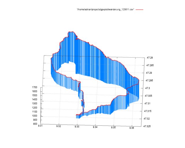 Eine solche, dreidimensionale Ausgabe der GPS Daten zu erzeugen ist mit der `splot`-Funktion sehr einfach.
@@ -102,4 +102,4 @@ Falls jemand den Artikel mit meinen Daten nachvollziehen möchte - das GPX-File
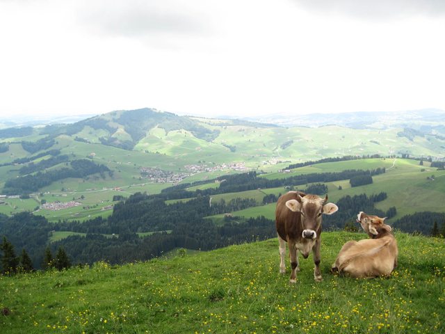
Zum Schluss hier noch ein Blick vom Weg auf den Kronberg Richtung Jakobsbad im Appenzell:
-
Eine solche, dreidimensionale Ausgabe der GPS Daten zu erzeugen ist mit der `splot`-Funktion sehr einfach.
@@ -102,4 +102,4 @@ Falls jemand den Artikel mit meinen Daten nachvollziehen möchte - das GPX-File
Zum Schluss hier noch ein Blick vom Weg auf den Kronberg Richtung Jakobsbad im Appenzell:
- +
+ --
cgit v1.2.3
--
cgit v1.2.3